


Jackson Voting District, Webster County, Missouri
About
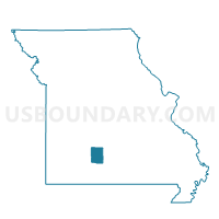
Outline

Summary
| Unique Area Identifier | 611575 |
| Name | Jackson Voting District |
| County | Webster County |
| State | Missouri |
| Area (square miles) | 40.66 |
| Land Area (square miles) | 40.54 |
| Water Area (square miles) | 0.11 |
| % of Land Area | 99.72 |
| % of Water Area | 0.28 |
| Latitude of the Internal Point | 37.43879360 |
| Longtitude of the Internal Point | -93.02692050 |
Maps


Graphs
Select a template below for downloading or customizing gragh for Jackson Voting District, Webster County, Missouri


Neighbors
Neighoring Voting District (by Name) Neighboring Voting District on the Map
- 1st Jackson Voting District, Greene County, MO
- Grant Voting District, Webster County, MO
- Jackson Voting District, Dallas County, MO
- Sheridan Voting District, Dallas County, MO
- Washington Voting District, Dallas County, MO
- Washington Voting District, Webster County, MO
Top 10 Neighboring County Subdivision (by Population) Neighboring County Subdivision on the Map
- Jackson No. 1 township, Greene County, MO (2,869)
- Grant township, Webster County, MO (2,449)
- Jackson township, Dallas County, MO (2,207)
- Washington township, Webster County, MO (1,616)
- Jackson township, Webster County, MO (1,549)
- Sheridan township, Dallas County, MO (1,530)
- Washington township, Dallas County, MO (919)
Top 10 Neighboring Unified School District (by Population) Neighboring Unified School District on the Map
- Marshfield R-I School District, MO (16,818)
- Dallas County R-I School District, MO (12,874)
- Fair Grove R-10 School District, MO (5,671)
- Laclede County R-I School District, MO (4,462)
Top 10 Neighboring State Legislative District Lower Chamber (by Population) Neighboring State Legislative District Lower Chamber on the Map
- State House District 145, MO (40,013)
- State House District 139, MO (39,224)
- State House District 119, MO (36,209)
Top 10 Neighboring State Legislative District Upper Chamber (by Population) Neighboring State Legislative District Upper Chamber on the Map
Top 10 Neighboring 111th Congressional District (by Population) Neighboring 111th Congressional District on the Map
Top 10 Neighboring Census Tract (by Population) Neighboring Census Tract on the Map
- Census Tract 46, Greene County, MO (7,124)
- Census Tract 4803, Dallas County, MO (6,855)
- Census Tract 4701.02, Webster County, MO (5,616)